Wildfire Maps
Keep an eye on these maps to rack the level and extent of the fires
- Check Lane County’s latest fire evacuation areas and levels here.
- The Lane County website also has information on the wildfires here.
Keep an eye on these maps to rack the level and extent of the fires
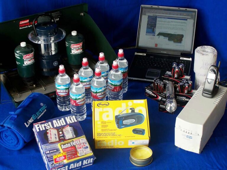
Source: LaneElectric.com Emergency & Outage Preparedness – Be Prepared Just In Case Lane Electric’s mission is to provide its members with reliable service – day and night. Despite our best efforts, severe weather and unusual circumstances can wreak havoc and cause a power outage that can last for hours or days. If you are currently…

The External Outreach Site is now Closed but Help is Still Available The FEMA External Outreach Site in Eugene located at Lane Events Center, 796 W. 13th Ave., Eugene, Oregon, ceased operations on Oct. 31, but Help is Still Available, see below. Oregon Residents: Still Time to Apply for FEMA Disaster Assistance SALEM, Ore.–Oregon residents…
Source: KVAL.com BLUE RIVER, Ore. — With the election and the upcoming freeze, it’s easy to forget about the devastating wildfires earlier this year. But up the McKenzie River, many are still dealing with two disasters “We lost everything!” said Dan McCall, a Finn Rock resident who’s recovering from the unthinkable after losing his home…
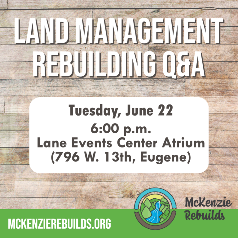
Lane County Land Management Division is hosting an in-person Q&A session about rebuilding for Holiday Farm Fire survivors on Tuesday, June 22, at 6:00 p.m. in the Lane Events Center Atrium (796 W. 13th Avenue, Eugene). If you have questions about the rebuilding process, please consider joining us. More information about rebuilding is available at www.mckenzierebuilds.org. Do…
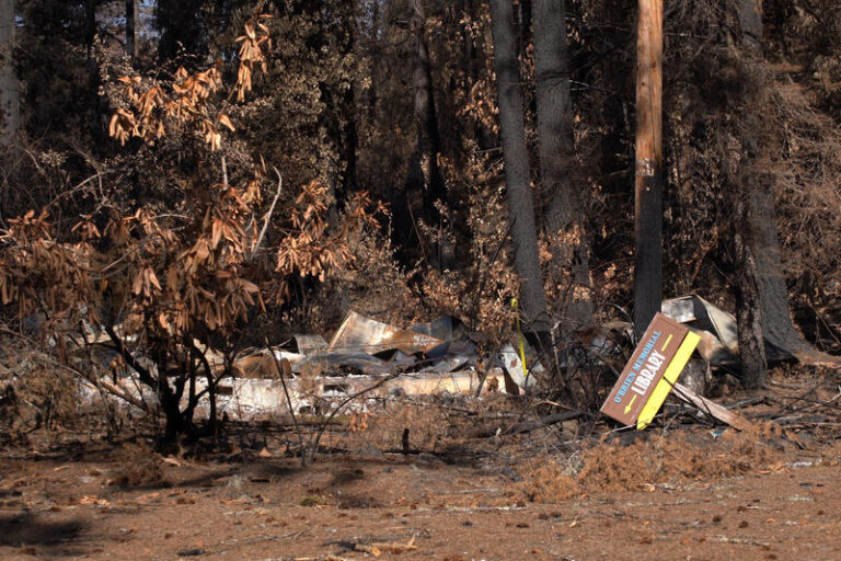
Source: KLCC.org credit Rachael McDonald The library was one of hundreds of buildings in Blue River destroyed by the Holiday Farm Fire last month. Community members are already thinking about how to rebuild it. The library in Blue River was named for Frances O’Brien, a teacher who started checking out books from her front porch…