Cleanup | FEMA | Holiday Farm Fire | Housing | News | PSA Alerts | Rebuilding | Resources | State Federal Aid
Similar Posts


Community | Donations | Holiday Farm Fire | Local Support | Vida | VMCC
BINGO To Return on August 14th
“Bingo at the Center” will return August 14th 7:00pm, but will be held at the Presbyterian Church in Walterville. Bingo at the Vida McKenzie Community Center began in August 2003 and has continued as a family fun night for everyone since. We are looking forward to bringing the bingo night back to our community after…
Cleanup | Environment | Forest | Highway 126 | ODOT | Trees
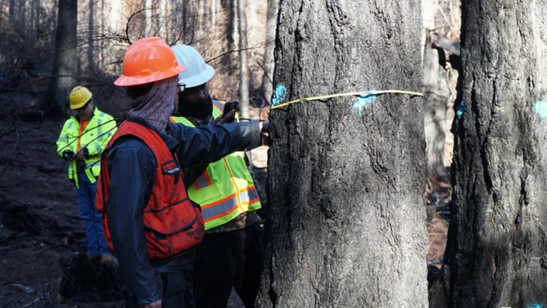
Re-Marking of Hazard Trees Underway Soon
When hazard trees were originally marked – between January and April of this year – several hundred trees statewide showed signs that they had at least a slim chance of survival. Trees may have demonstrated a greenery crown scorch right at the minimum threshold or a bark char marginal enough to give it a possibility of…
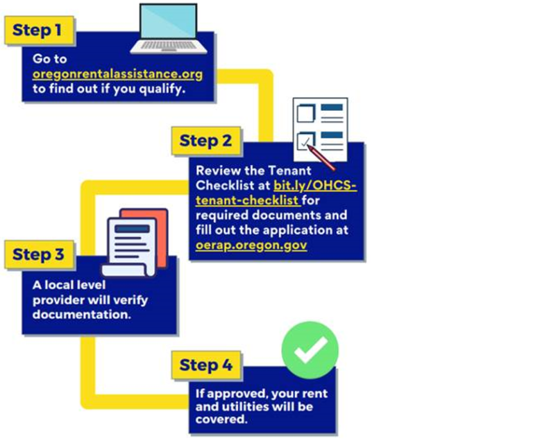
Oregon Emergency Rental Assistance Program
Source: OregonRentalAssistance.org Beginning May 19, 2021, qualified renters who have experienced financial hardship due to the coronavirus pandemic, and are at risk of homelessness or housing instability, may apply for the Oregon Emergency Rental Assistance Program (OERAP). This program is not a loan, which means those who receive assistance will not have to pay back…
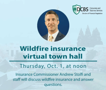
Get Help Sorting Out a Wildfire Insurance Claim
Need Help Sorting Out an Insurance Claim from the Wildfires? Oregon Insurance Commissioner Andrew Stolfi will be holding statewide virtual Wildfire and Insurance Town Hall to answer questions about wildfire insurance and the claims process. Tune in to the live stream on Thursday, October 1, at noon on the division’s video webpage. You can also…
Sign Up Before Oct. 16th for Hazardous Debris Removal
You can donate directly to the McKenzie CDC above who will direct funds to recovery efforts in the McKenzie River valley. Use the Paypal Donate button above to help support the residents of the valley so badly scarred by the Holiday Farm Fire. Today Lane County have opened up a scheme allowing fire damaged…